Cyaneae: The Lycian City of Sarcophagi on a Rocky Ridge
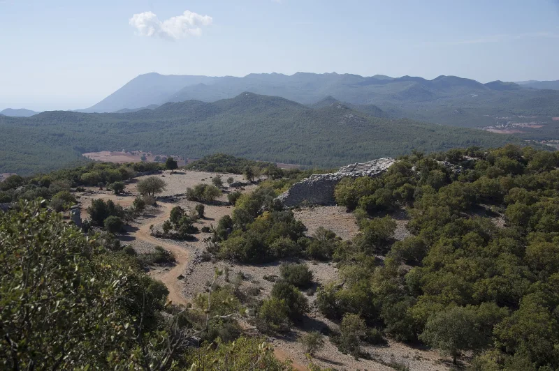
On a steep rocky ridge above the village of Yavu, in the Demre district of Antalya Province, lie the ruins of one of the most unusual cities of ancient Lycia—Cyaneae (Kyaneai in Turkish, Xban- in Lycian). Getting up here is no easy feat: a 30–40-minute hike along a trail through oak and juniper trees, past scattered marble fragments. The reward is a whole field of preserved Lycian sarcophagi, standing densely among the city’s ruins. From here, there is also a view of Kekova Bay, Kekova Island, and the distant sea. Cyaneae is a place where Lycian funerary architecture is displayed perhaps more densely than anywhere else.
History and Origin
Cyaneae has been known to ancient authors since the Hellenistic era. The Lycian name of the city—Xban—appears on coins and in inscriptions; the Greek name Κυανέαι is sometimes derived from the word “blue” (κύανος), although the exact etymology is debated. According to one hypothesis, the city encompassed three adjacent settlements—Yavu proper, Tousa, and Ghiouristan—linked by a common urban territory.
As part of the Lycian League, Cyaneae was one of several influential cities. According to available data, it held a prominent position alongside Phellos and Candyba. During the Roman era, the city acquired a typical set of public buildings—a theater, an agora, baths, and an aqueduct. A small sanctuary was also located here—the oracle of Apollo Thyrxeus, mentioned by Pausanias.
During the Byzantine period, Cyaneae became a bishopric. By 640, the city’s bishop was ranked fifteenth among the suffragans of the Metropolitan of Myra. Following Arab raids and earthquakes, the city gradually declined; the population moved down into the valley, while the stone settlement on the ridge became deserted and has survived with almost no later alterations.
Architecture and What to See
Lycian sarcophagi and the necropolis
The main visual impression is provided by dozens of Lycian sarcophagi with their characteristic “pointed” lids, imitating an upturned ship’s hull. They are arranged in groups along the trail and among the city ruins, sometimes literally just a step away from one another. In terms of density and preservation, this is one of the most impressive Lycian necropolises. Many of the sarcophagi feature reliefs and Lycian/Greek inscriptions.
Rock-cut tombs
Carved into the cliffs surrounding the city are typical Lycian rock-cut tombs with facades imitating wooden architecture: featuring beams, pediments, and sometimes columns. Three particularly large rock-cut tombs have been preserved in the Ghiouristan area.
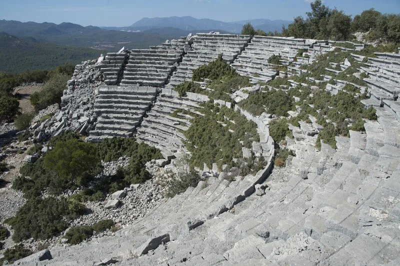
Theater and Acropolis
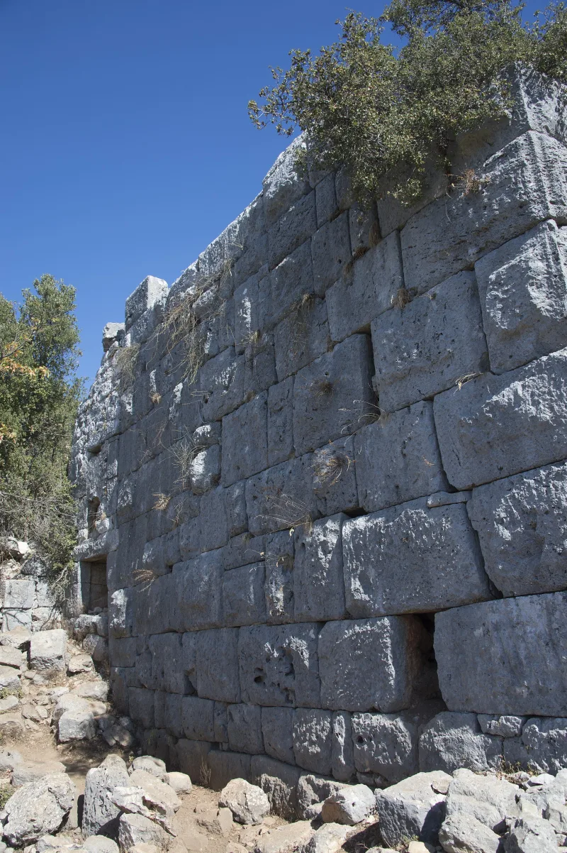
On the southern slope stands a Roman-era theater with a diameter of about 50 meters. Rows of stone benches and part of the scaenae frons have survived. Above it lies the acropolis, featuring sections of polygonal masonry and cyclopean walls typical of the Archaic period.
Cisterns and Public Buildings
Water on the ridge has always been a problem: the inhabitants of Cyaneae carved cisterns into the rock to collect rainwater—there are several dozen of them, and many have survived to this day. The foundations of baths, an agora, and several early Christian churches are also visible.
Interesting facts and legends
- The concentration of Lycian sarcophagi in Cyaneae is one of the highest in the region. Archaeologists have identified over a hundred preserved stone tombs here and in the surrounding area.
- The Lycian name Xban- has been preserved on local coins. This is a rare example of the direct recording of a city’s autochthonous name in epigraphy.
- The Oracle of Apollo Tyrx, mentioned by Pausanias, was one of the Lycian oracles. The exact location of the sanctuary in Cyaneae has not yet been definitively identified.
- The modern German “Lykische Survey” (led by Frank Kolb since 1989) has studied Cyaneae as one of the key sites for researching the rural landscape of Lycia—a series of publications reconstructs the structure of estates around the city.
- During the Byzantine period, the see of Cyaneae was listed as a suffragan of Myra (the birthplace of St. Nicholas)—a city located an hour’s journey away at the foot of the mountain.
How to get there
Cyaneae is located in the province of Antalya, Demre district, GPS coordinates: 36.247, 29.818. The nearest airport is Antalya (AYT), about 150 km away via a winding coastal road through Finike and Demre. It is more convenient to approach from Demre (Myra) or Kaş—both towns are approximately 25 km from the site.
Local buses (dolmuş) run to the village of Yavu from Demre and Kaş. A hiking trail about 2–3 km long with a 200-meter climb leads from the village to the excavation site. There is also a dirt road for off-road vehicles, but it becomes impassable in the rain. You can hire a guide or a donkey in the village itself.
Tips for travelers
The most important thing is your footwear: the trail is rocky, the slope is steep, and fragments of marble are hidden in the grass. Water (at least 1.5 liters per person in summer), a hat, and sunscreen are essential. The best time to visit is April–June and September–November; in summer, the climb up the exposed slope is very difficult.
Allow at least 3–4 hours: 40 minutes for the ascent, 1.5–2 hours for the tour itself, and the same amount of time for the descent. It’s best to bring a light picnic—there are no cafes at the excavation site. The village of Yavu offers modest cafes and, occasionally, local olive oil.
For photographers, the golden hours are early morning (sarcophagi in side light, silhouettes against the sea) and sunset (warm light on the rock tombs). Combine a visit to Cyaneae with a day trip along the Demre (Myra) – Kekova – Cyaneae – Kaş route: four stunning Lycian sites in a single itinerary.